true_nations_map
Table of Contents
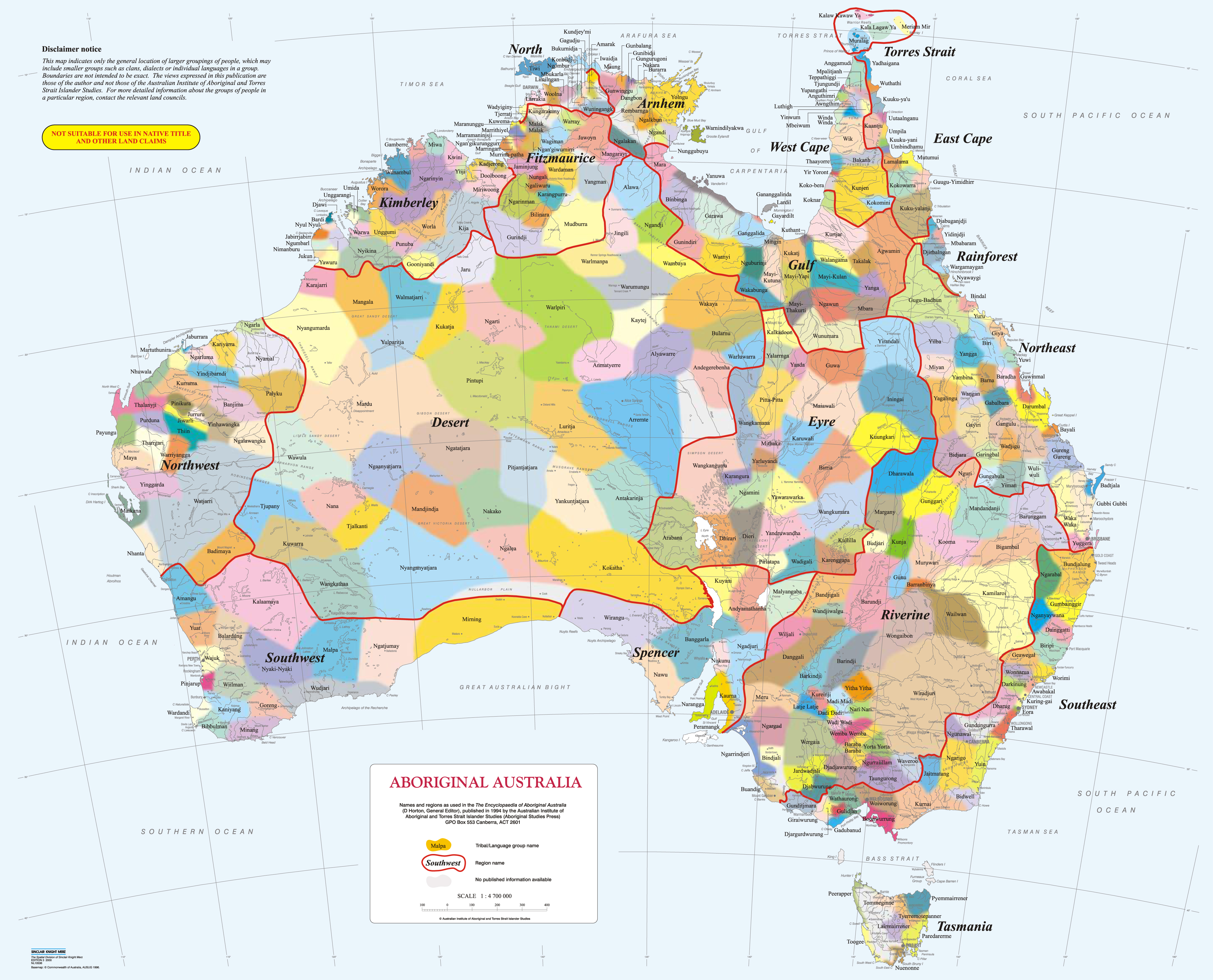
True Nations Map (Working Title)
NB: There's already a project that does this, and includes other countries:
The idea is to create an 'overlay' for OpenStreetMap that would show the nations of Australia.
I have no idea how to do this.
As best I can tell the boundaries on the maps are not, and are not able to be(?), perfectly accurate.
see: https://aiatsis.gov.au/aboriginal-studies-press/products/aiatsis-map-indigenous-australia
Considering that these borders change over time, it's not really possible to make an accurate map.
David R Horton is the author of the AIATSIS map, the latest version is from 1996.
Links
Maps
-
- http://ourlanguages.org.au/indigenous-language-map/ - someone done a GMaps one, but it seems to be gone?
- http://nationalunitygovernment.org/pdf/boundaries-map.pdf - good one, shows more landmarks
Other Places
Open Street Map
Etc.
- https://datagovau.ideascale.com/a/dtd/Shapefile-for-Aboriginal-Australia-Map/33804-26233 - person looking for map data 'shapefile'
3ds
android
artist
audio
australia
cli
company
config
film
fixes
form
game-maker
genre
guide
hardware
index
instrument
internet
japan
language
linux
list
multiplayer
music
music-making
nintendo
open-source
organisation
person
project
protocol
ps2
recommendations
sandlot
series
snes
software
song
sport
switch
theme
tool
translation
video
videogame
videogame-console
videogames
website
wiki
windows
true_nations_map.txt · Last modified: by rjt