NB: There's already a project that does this, and includes other countries:
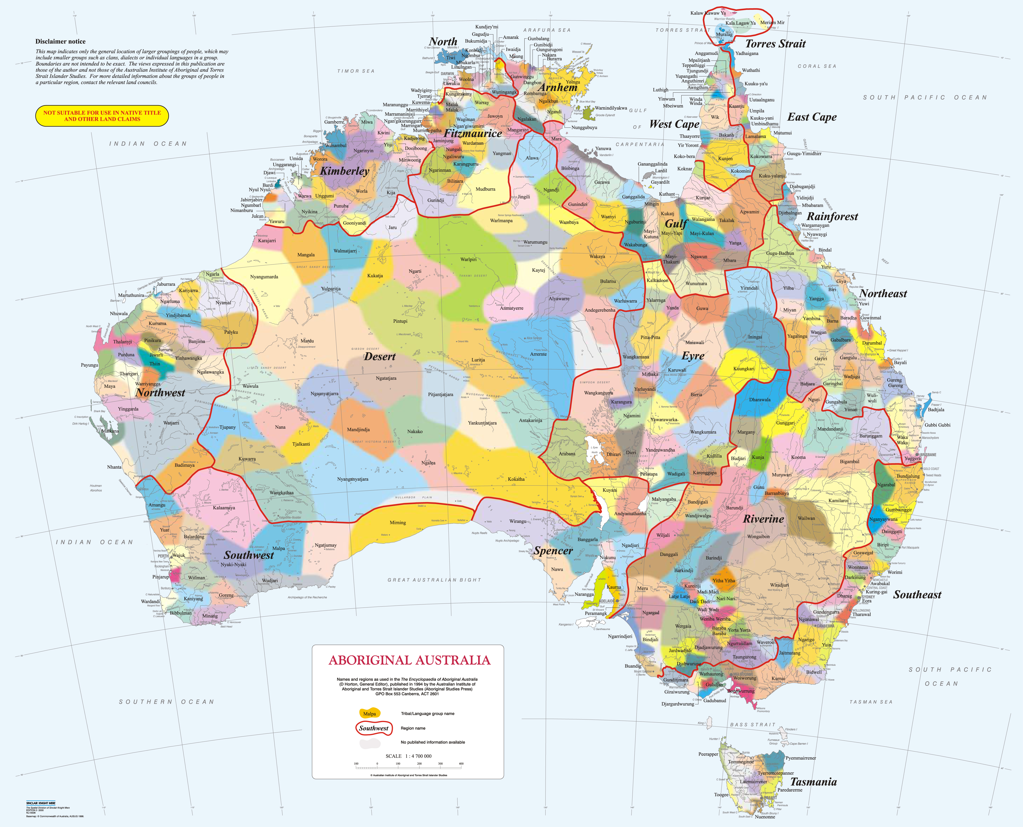
The idea is to create an 'overlay' for OpenStreetMap that would show the nations of Australia.
I have no idea how to do this.
As best I can tell the boundaries on the maps are not, and are not able to be(?), perfectly accurate.
see: https://aiatsis.gov.au/aboriginal-studies-press/products/aiatsis-map-indigenous-australia
Considering that these borders change over time, it's not really possible to make an accurate map.
David R Horton is the author of the AIATSIS map, the latest version is from 1996.